Apple launches 3D maps
Apple has launched 3D map viewings for four major cities.
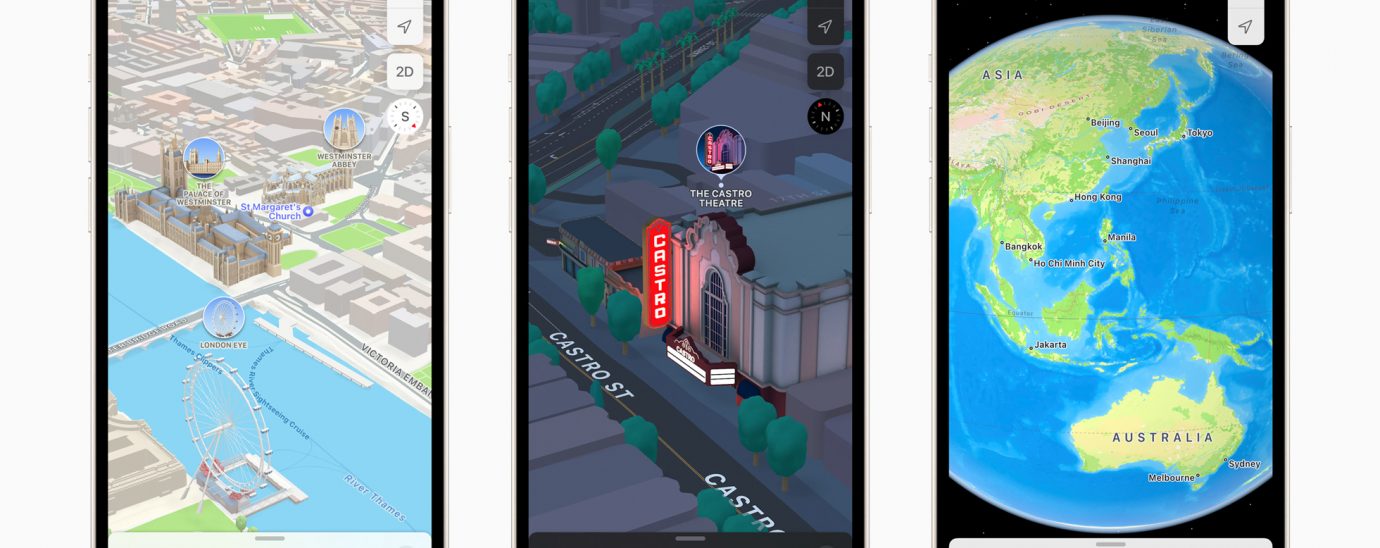
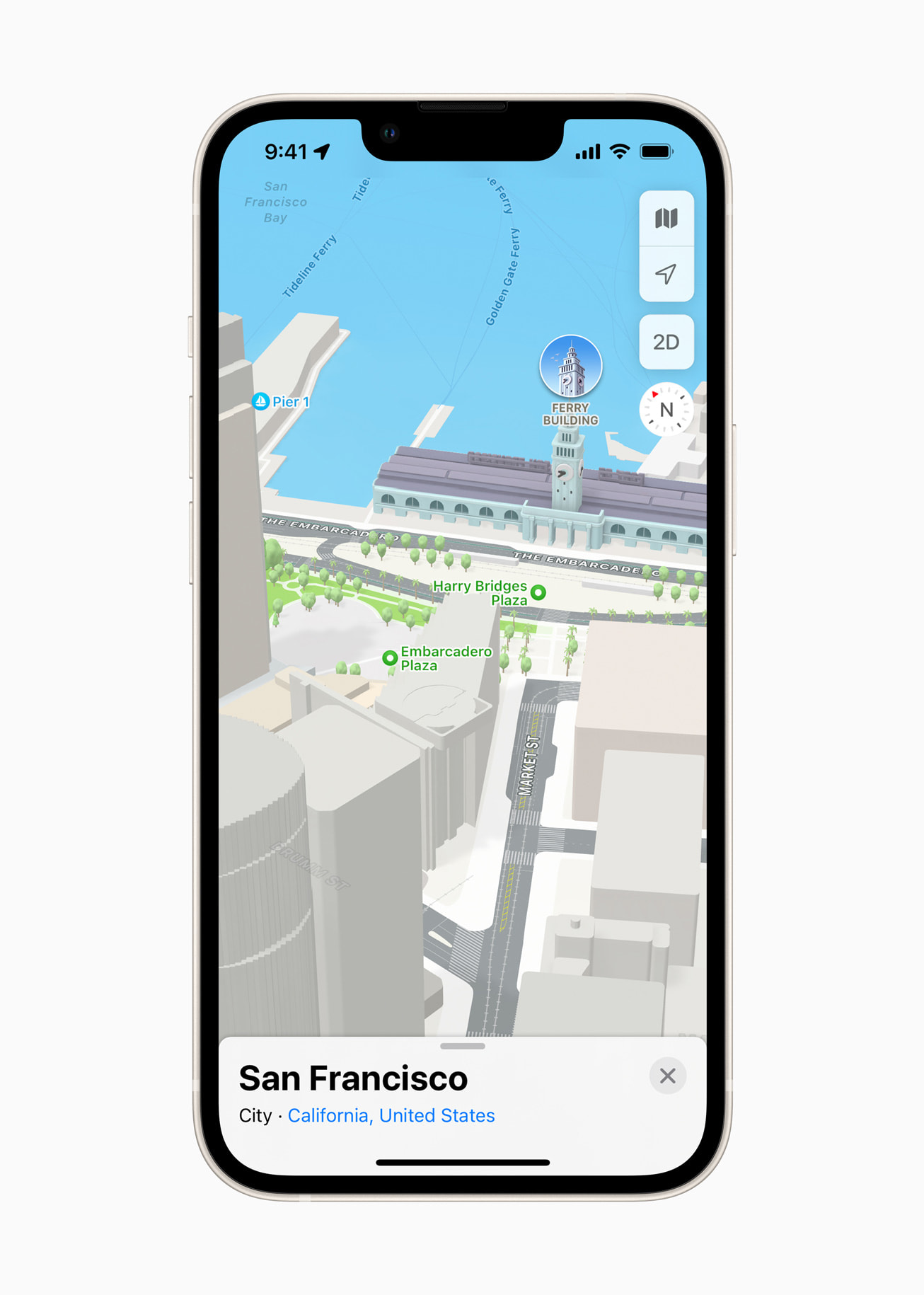
Apple maps will get a notable upgrade in iOS 15. Users will now be able to access 3D rendering of four major Western cities, over more details, driving routes and better navigation. The first cities included in this update are London, Los Angeles, New York City, and the San Francisco Bay Area, with more to be added soon.
“We are thrilled to offer the new Apple Maps experience. Maps is the best way to navigate the world: It is easy to use, beautifully designed, and built with privacy at its core. With this update, we are pushing Maps even further, providing more ways for users to discover the natural beauty of the world and explore cities through a new 3D view,” said Eddy Cue, Apple’s senior vice president of Services. “Our goal has always been to build the best and most accurate map in the world. The upgrades in Apple Maps are a continuation of that effort, with features and an attention to detail that only Apple can deliver.”
An enhanced travel experience
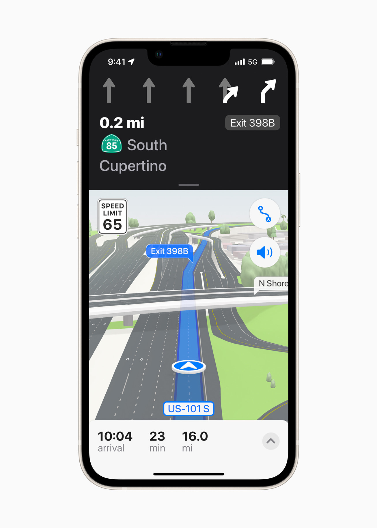
Maps will now have enhanced navigation, providing users with more details clearly, such as turn lanes, medians, bus and taxi lanes, and crosswalks. In addition, the 3D view will assist in making sections that cross over easier to view.

For those who take public transport, Maps now displays nearby stations at the top of the screen. Users can also pin their regular lines in Maps to ensure that their prefered route is as accessible to search as possible.
Enter AR
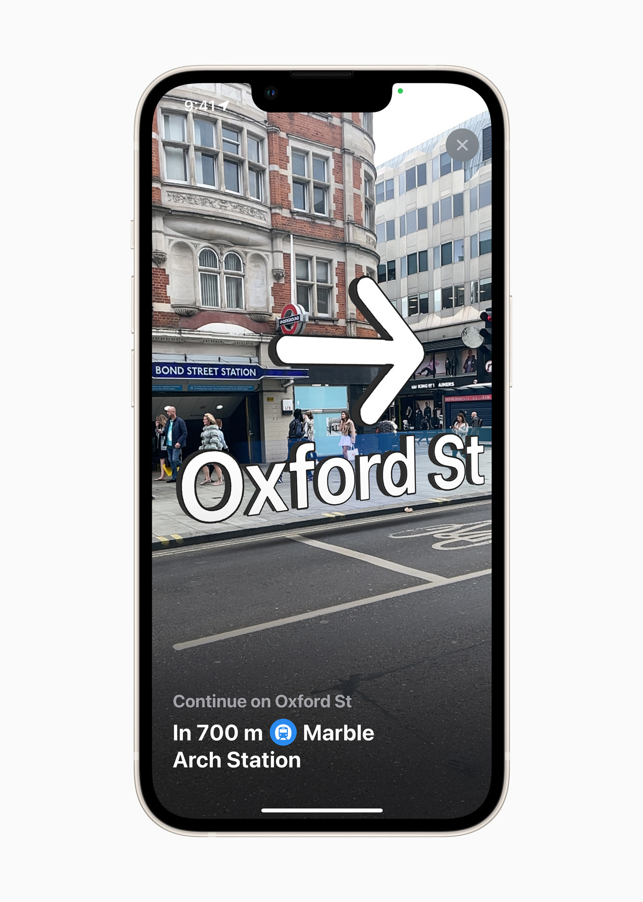
Apple Maps now offers step-by-step walking guidance in AR. Users can do this by raising their iPhones to scan buildings in the area. Maps will then generate detailed directions based on real-world imaging.
Other useful features of maps
Apple Maps offers many useful features in addition to the new updates available in iOS 15:
Look Around
Look around offers users a way to explore parts of the world through an interactive 3D street-level experience and a smooth, seamless 360-degree view.
Cycling directions
Cycling directors shows the elevation for a ride, and how busy a street is. It can also show whether there are stairs along a route.
Speed cameras
Maps can let users know when approaching speed and red-light cameras along a route, with the added ability to see where cameras are located on the map.
Share ETA
Users can share their estimated time of arrival with others.
READ MORE:
- A summary of Apple’s September event, including iPad Mini
- “California streaming” Apple’s September 2021 event: Live updates
- iOS15: Apple to begin rollout of driver’s licenses and state IDs in Apple Wallet
- Apple faces backlash against new scanning tool that detects child sex abuse images
Incident reports
Users can report accidents by informing Siri. For example: “There’s an accident up ahead” or “There is something on the road.” Users can also report when a reported incident has been cleared.
Flyover
With flyover, users can see major metro areas with photo-realistic views.
Favorites
Users can save favourite and regularly used locations.
Indoor Maps
Users can navigate large indoor spaces such as airports and malls to discover what floor they’re on, and locate stores.
For more news from Top Business Tech, don’t forget to subscribe to our daily bulletin!
Follow us on LinkedIn and Twitter